Bikepacking the Simcoe County Loop Trail
The following was provided by writer/photographer, Jody Wilson.
Fresh off an amazing bikepacking trip with the folks from Mariposa Bicycles in July to the Karwartha’s, I had the idea to tackle the Simcoe County Loop Trail (SCLT) over the August long weekend. The “Loop” trail is made up of a series of rail and waterfront trails stitched together forming a 165km loop around the central/northern portion of Simcoe County. Two thirds of the loop is also associated with the Trans Canada Trail, which joins together over 150 communities in Ontario through a collection of multi-use trails. The SCLT links together small farming communities with waterfront towns, boasting stunning vistas and panoramic views that leave you wanting more.
The decision of where to start our ride was based on a discussion with the local expert from Cycle Simcoe, Brendan Matheson. With plans to experience the loop over the course of two days, we needed a stopping point approximately half way through the loop that had sufficient accommodation for a Saturday evening stay. After weighing all the options, we decided that it would be best to start in the City of Barrie and ride the loop in a clockwise fashion. We would stop in Midland at the 80km mark for the evening and then continue on with the remainder the next day; taking in Port McNicoll, Victoria Park, Waubaushene, Coldwater, Orillia and then back to Barrie.
In my research leading up to our ride, I learned that our route for the first day was the North Simcoe Railway Line, which was built in 1878 to replace the stagecoach service that ran between Barrie and Penetanguishene. Previous to the rail system, taverns were located very close together along the route (every 2km) to house weary travelers.
With our bikes loaded up we departed downtown Barrie in search of a day of adventure. Getting out of the city was fairly simple, as we left early enough to avoid any local traffic. The residential built up area quickly became typical Ontario rural farmland as we left the sounds of the city behind us.
North Simcoe Rail Trail (Barrie to Elmvale)
We caught the North Simcoe Rail Trail just off George Johnston Road. Immediately I was excited. As we began our day rolling through some narrow rail trail, I took in all the sights, sounds and smells of the Minesing Wetlands. Blue flowers lined both sides of the trail as we headed towards Phelpston. There are plenty of things to see along the way, including Josephine, a ghost town from the early timber days, Mayers Marsh, the Minesing Station Park, dairy farms and dense hardwood forests.
Our first stop for a coffee was in the small town of Elmvale. With no real traditional local cafe in town, we decided to pop our heads into the Elmvale Bakery for baked goods and grab a coffee at the local Coffee Time just down the street. We sat in the sun at the park across the road and listened to a local band play a few tunes before heading out again.
Elmvale Natural Spring
Tiny Trail (Elmvale to Penetangushene)
As you leave Elmvale through Heritage Park, there is a short bypass that takes you onto County Road 27 for a short time until you pick up the trail again just off of County Road 6 South. However, before you get any farther, this is a great spot to stop and fill your bottles. Elmvale, and aptly named Springwater Township, is well known for having some of the cleanest water in the world. Be sure to check out the artisan wells located on County Road 27 – just south of Flos Road 10 West you will see a small red clad building on the east side of the road. Stop and fill your bottles, it’s not every day you will have an experience like this. Please note that this is one of areas of trail improvement for the near future. I’ve heard they are working on a solution to develop better trail access at this point, as the highway is very busy at times. We were able to ride along the side of the road, but the highway was very busy.
As the trail continues north towards Wyevale, it runs parallel with the highway. Despite this, you still feel like you are hidden away in the forest. With some sandy sections and several small rail bridges, this section was a bit more challenging than the earlier portions of trail. Wyevale provides a small picnic area if you are carrying your own food, with plenty of tables and places to rest trail side.
The Tiny Trail continues through mature forests and fields eventually veering to the north east heading towards Penetanguishene. As you near this Georgian Bay shoreline town, the trail turns to pavement and the fun begins as you fly over eleven bridges that cross the Copeland Creek. After a long day in the saddle of riding straight, flat trails, this section in the forest was definitely a breath of fresh air.
Penetanguishene Trail
Eventually you find yourself cycling through a graffitied steel tunnel under Bridge Road and onto the Penetanguishene Rotary Waterfront Trail. The trail meanders along the waterfront which includes a beach, playground, skate park, picnic facilities and stunning views of the harbour. We were lucky enough to be passing through the same day the “Urban Slide” was in town. After taking in some of the excitement from the festivities, we continued to follow the trail through the maze of streets to the Mid Pen Link Trail.
Mid Pen Trail Link
The Mid-Pen link trail is a paved section that runs between the two communities. It starts with a great downhill section that continues around numerous corners, simulating the feeling of riding a roller coaster. The trail meanders through a stunning mature hardwood forest, eventually connecting you with the Rotary Midland Waterfront Trail.
Our first day of riding ended at the Midland Harbour. King Street runs directly away from the harbour where you will find several restaurants and coffee shops to suit all tastes. If you’re looking for a great lunch, be sure to check out the amazing paninis and soup at Cibolette Et Cie. For the best java in town, Grounded Coffee Co. is located just another block and a half up the street. This little cafe is hopping with people and they absolutely love cyclists, so be sure to stop in while you are there.
There are a variety of places to stay in Midland. To make the most out of your stay, it would be best to stay within the downtown area. There are limited places in the downtown, mostly B&B’s so be sure to book well in advance if you can. Since our trip was last minute, most places were fully booked but we were lucky enough to obtain a reservation at the Best Western Highland Inn & Conference Centre, which is located approximately 3 km from the downtown area. During the evening we were able to grab a very reasonably priced cab back to the downtown area to enjoy dinner and watch the sunset behind in the harbour, a truly amazing finish to a great day.
Day two started off right with a smoothie and a tasty espresso from Grounded Coffee on the main street. As we left Midland, we continued to ride along the waterfront, taking in the beautiful panoramic views of the harbour.
Leaving Midland you cross a bridge that leads to Sainte-Marie among the Hurons, Ontario’s first European settlement dating back to 1639. The last time we had visited the site was when we were both young children, so we decided to stop in for the experience. We stayed for roughly an hour, watched a 15 minute film and walked around the historic settlement taking in everything the cultural site had to offer. There was plenty of bike parking located at the front of the building, just be sure to bring a lock with you. We didn’t travel with locks, but the staff allowed us to store our bikes just inside the main foyer where they were safe.
Tay Shore Trail
The Tay Shore Trail runs between Midland and Waubaushene passing through Victoria Harbour on its way. This section of the trail is well maintained with an asphalt surface, filled with joggers, cyclists and walkers. A few kilometers east of Midland is the Trestle Trail which takes you into Port McNicoll where you can check out the S.S. Keewatin docked in the harbour. Here you can take a tour of the historic passenger ship that carried people across Georgian Bay for over 50 years.
Ems Cafe in Coldwater
As you pass through Victoria Park there is a Cycle Simcoe bike stand if you need to make any adjustments or repairs to your bike. There is also a pump if your tires are in need of inflation.
The paved portion of the the Tay Shore Trail comes to an end as you pass under Highway 400 on the other side of Waubaushene. Back on gravel, it is a quick 7 km ride to Coldwater, a perfect place to stop and check out Em’s Cafe. We grabbed an espresso and pastry and sat outside in the sun. Coldwater is a cute town, a great place to people watch and enjoy the atmosphere of the small quaint downtown.
Uhthoff Trail
On the east side of Coldwater we picked up the Uhthoff Trail and headed east inland toward Lake Couchiching. This section of rail trail is unlike the other sections. At times it appears as two single track paths with grass growing in the middle. Don’t let this discourage you, this was some of the smoothest parts of the non-paved sections on the SCLT. Cycling through farm county and hardwood forests, the trail is very sheltered from most of the elements. Keep an eye out for farm crossings, wetlands, Purbrook Creek and the bridges over the North River and Silver Creek. As you approach Orillia, the trail surface changes to something similar to a gravel road, making it very tough to navigate at times. This is a shorter section, so be sure to stay in the same track as everyone else and you’ll be fine.
Orillia Millennium Trail
Passing under Highway 11, the trail turns into the Orillia Millennium Trail. As Lake Couchiching comes into sight, the trail meanders through Couchiching Beach Park, Central Park and Veterans Memorial Park. We arrived in town just in time for Funfest, an annual festival put on by the local Lions and Rotary clubs. With a midway, arts and crafts vendors and food trucks: it definitely added the excitement of arriving in Orillia. We decided to stop for lunch at the Mariposa Market which is located in the busy downtown core. We had heard that it was a local landmark was extremely busy, but well worth it. After figuring out how to order, we settled in with some delicious veggie sandwiches and cookies, all washed down with some refreshing lemonade. There are many things to see and do in Orillia, so be sure to set aside time to explore when you are here.
Oro-Medonte Rail Trail
After navigating a few streets in Orillia, the Oro-Medonte Rail Trail leaves town heading south west towards Barrie. This section of trail is long and straight. The surface is great and the trail is very well sheltered from any environmental elements. Over this section of trail you will see large wetland areas, beaver dams and mature forests. Keep your eyes peeled for osprey nests, blue herons, deer and other wildlife.
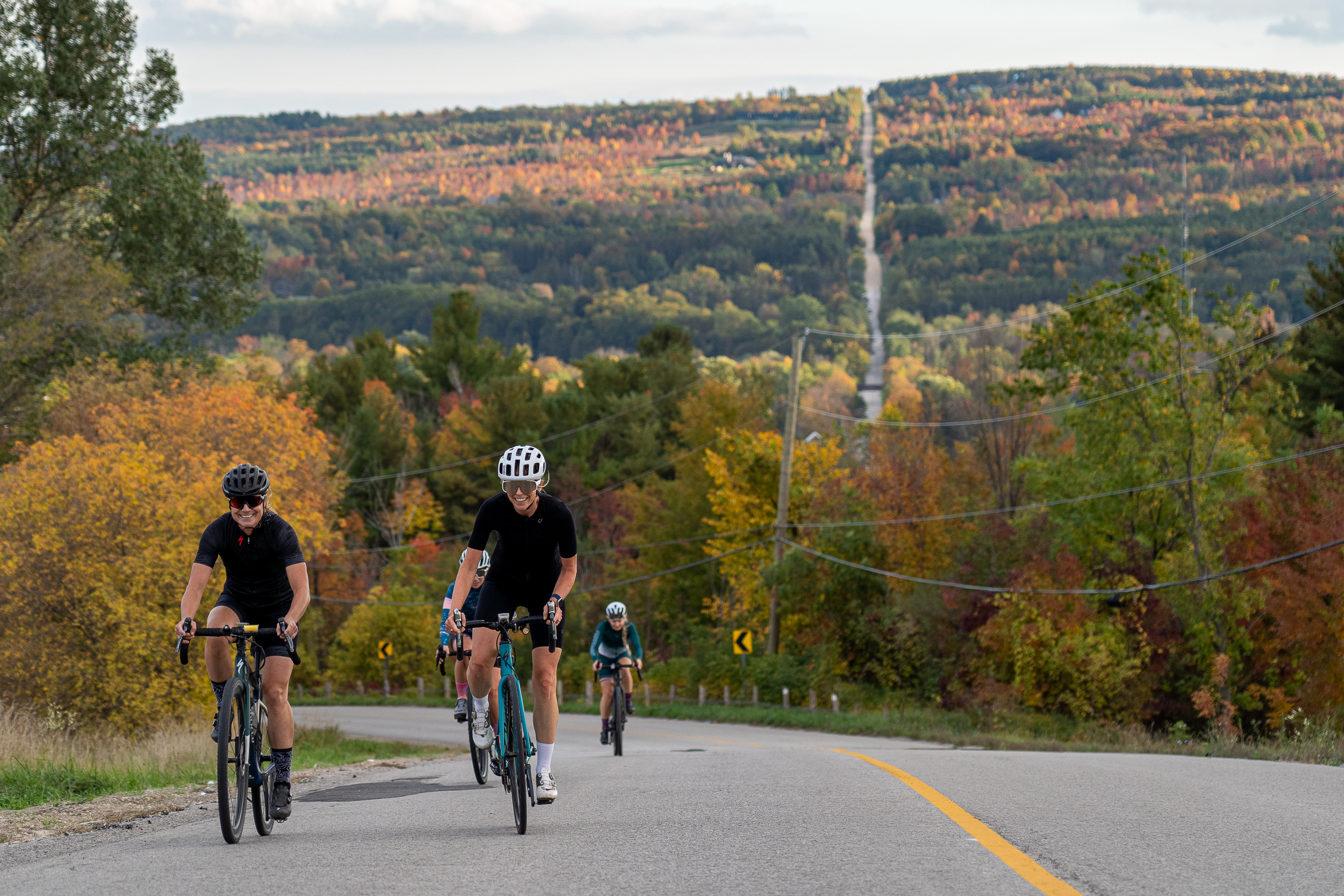
As we rolled into Barrie along the waterfront, we chatted about what an amazing experience we had. We discussed doing it again, but maybe in the reverse direction next time, or maybe taking a large group of friends with us during the fall to take in the colours and the changing seasons.
Our experience riding the Simcoe County Loop Trail was incredible. The trail sections are all so unique in their own little ways. Gravel, stone dust, paved, hilly, twisty or narrow, the majority of the trails were excellent to ride on. I would highly recommend discovering the SCLT over the course of two days, maybe even a long weekend so you have one extra day to explore. For those of you that can ride anytime of the week, this would make a great mid-week excursion.
Day One: Strava Route
Day Two: Strava Route
Currently the SCLT is just being completed as the municipalities and County work to close the links. Check out the Cycle Simcoe website for updates or order a copy of the printed map for the most up to date route.


